Winter Ramsay Round Record
The Ramsay Round was first completed in less than 24 hours by Charlie Ramsay in July 1978. He started and finished at Glen Nevis Youth Hostel, at the foot of Ben Nevis, completing a non stop run across some of the toughest mountain terrain in Britain. Charlie Ramsay’s route is now known as the ‘Ramsay Round’ and the challenge is to complete it in less than 24 hours.
The Ramsay Round is one the ultimate endurance running challenges with its huge mountains, sheer cliff faces, knife edge ridges and desolate remoteness. The distance is approximately 63 miles and the height gain is around 30,000 feet (which means there is also 30,000 feet of descent!). In winter it is much, much tougher with 8 hours (or less) of daylight, snow, ice and freezing temperatures.
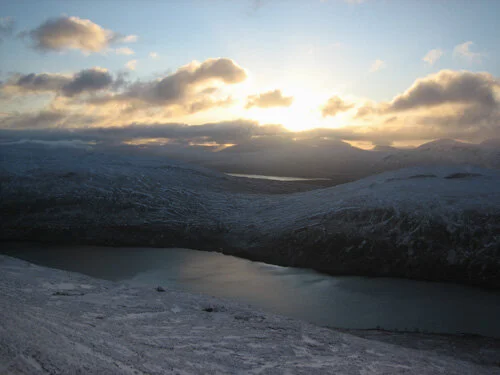
Sunrise over Loch Eilde Mor at the start of the Mamores.
Glen Nevis Youth Hostel 08:28
Thursday 14th February 2008
Often, just starting is the hardest part of any challenge.
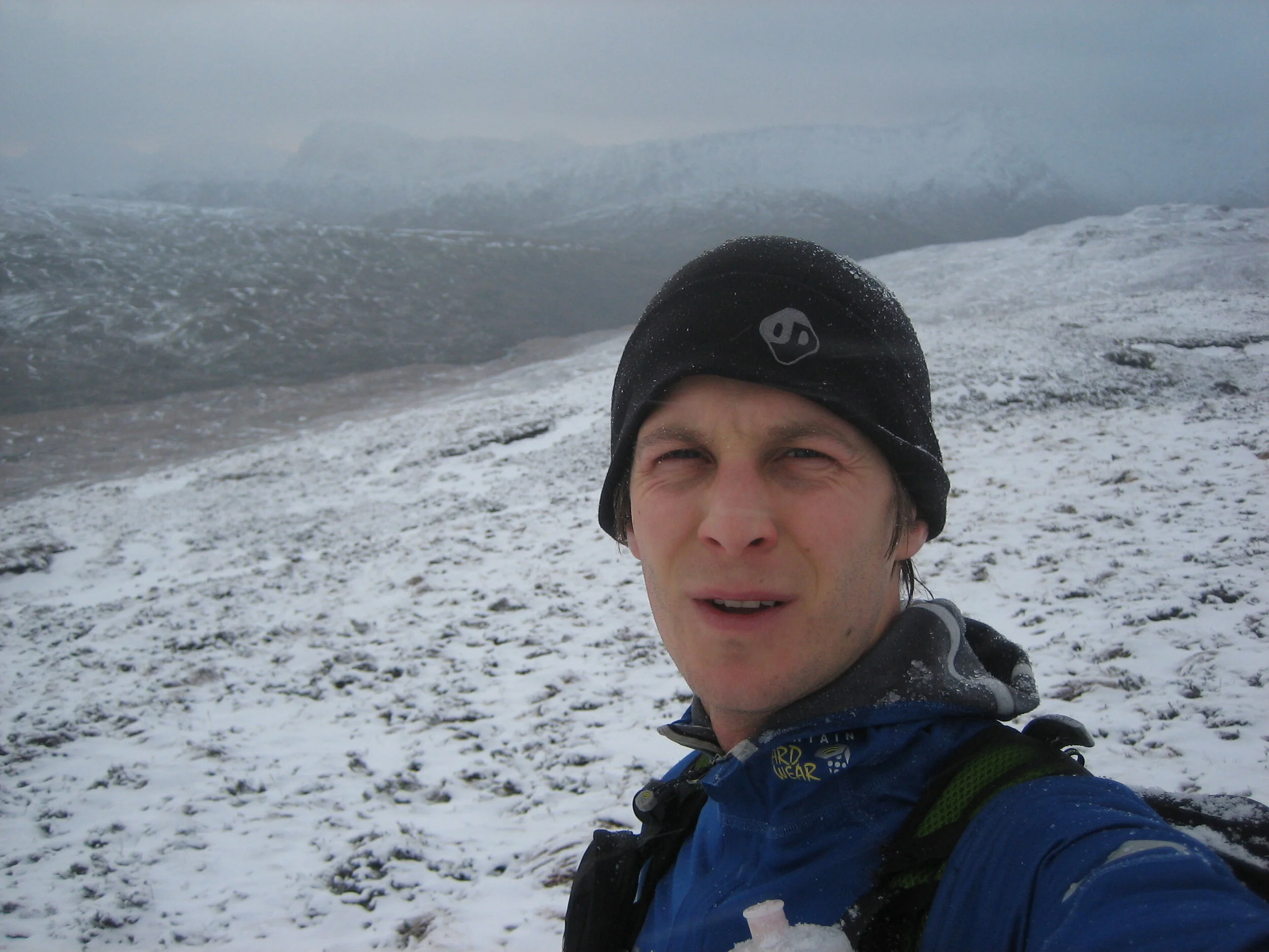
This morning, I needed no encouragement. It was the start of a perfect winters day; blue sky, sunshine, hardly a breath of wind and the mountain tops coated in a glistening layer of névé icing. Despite being such an enticing morning, setting off into the Scottish winter wearing lycra tights and a windproof top for a solo, unsupported attempt on the Ramsay Round still felt fantastically committing.
The gate on the bridge across the River Nevis slammed shut behind me and a new world of mountains and solitude beckoned. I started running up the flanks of Ben Nevis. Quickly the valley dropped away and the Glen Nevis Youth Hostel, my starting and finishing point, blended away with it. As the angle steepened, I had to throttle back my enthusiasm and settle into ‘power walking’ mode.
My strategy depended on being able to move fast. If the weather deteriorated, especially if it rained, I’d be in big trouble. Back in November, I was deliberately on the Ben in poor weather, wearing what I was wearing now to test its appropriateness. The combined effect of the wind and rain had steadily sapped my energy until I’d dived into the summit shelter for some respite. Here, I’d found two disorientated hill walkers. Guiding them down through the cloud was all the excuse I’d needed to conclude my clothing test. Lesson learned. As I focused on the repetitive trudge trudge upwards, I knew that any change in the weather today would almost certainly result in having to abandon my attempt.
Before leaving Sheffield I’d weighed my pack at 8.5kg (including a litre of water). During the overnight drive northwards I’d worried about the weight of my pack, knowing that it was just too heavy for me to move quickly for 20+ hours. I checked in with Heather, my girlfriend back in Sheffield, for a final weather forecast late on Wednesday night. She confirmed the stella forecast for the next 24 hours. I acted on the nagging concerns I had had all day and decided to dump most of my spare clothing, about a 1/3 of my food, my camera and anything else that I didn’t feel was absolutely essential.
With a pack that was now closer to 6.5kg, I felt much happier as the summit of The Ben came into view. One concession to extra weight was my mobile phone, which I now pulled out of my pocket. The phone was part of my safety plan rather than a luxury. As I passed each summit, I intended to send a text (Summit 1 OK, Summit 2 OK etc) to Heather and Gary Tompsett. If I failed to text and didn’t show up, then at least the search window would be relatively small.
Ben Nevis 09:55
I tagged the summit cairn, hit the send button and changed direction, heading south east, and downhill.
The decent down Carn Mor Dearg Arête was my first chance to move fast since starting. The CMD Arête can be a formidable obstacle and I know of at least one anticlockwise Ramsay Round that failed here due to ice. Today there was hard névé running in a narrow strip along the northern edge of the arête before plummeting down into Coire Leis a thousand feet below. Dropping down into Glen Nevis on the other side of the narrow arête, big rocks and boulders stuck out of the snow, slowing my progress. Clearly the fastest running would be right on the edge, literally a few centimetres from the breath taking drop into Coire Leis. Ice axe in hand, I ran along this edge. If I said I enjoyed the exposure that would be misleading… I positively thrived on it.
The climb back up to the summit of Carn Mor Dearg was a harsh reality check.
Carn Mor Dearg 10:29
Tagging the summit cairn, I turned right and to the east. The descent from the summit was steeper and longer than I had expected, dropping from 1220m to 830m and onto a compact little col with great views up sweeping Scottish mountain valleys to the north and south. There had been plenty of snow on this descent and I couldn’t decide if bum sliding on the hard névé was quicker than zigzag running. I opted for running, thinking I’d save the bum sliding for when I really needed it!
It wasn’t possible to see an established path from the col, leading up towards Aonach Mor, because of the snow cover, so I just headed straight up, pumping my knees with my arms to help reduce the strain. I was enjoying myself. Cold winter air and the weak winter sunshine are a great combination.
Aonach Mor 11:18
I had some walkers to catch. As I’d turned to jog the final 500m to the summit of Aonach Mor I’d passed two walkers, a middle aged coupled, walking towards the summit of Aonach Beag, and naturally I was determined to catch them before they reached it. The running off the summit of Aonach Mor was beautiful; gentle slopes covered in a hard crust of snow made for a fast decent. I caught the walkers quickly and as we climbed up to Aonach Beag together, we chatted briefly, before I pulled away.
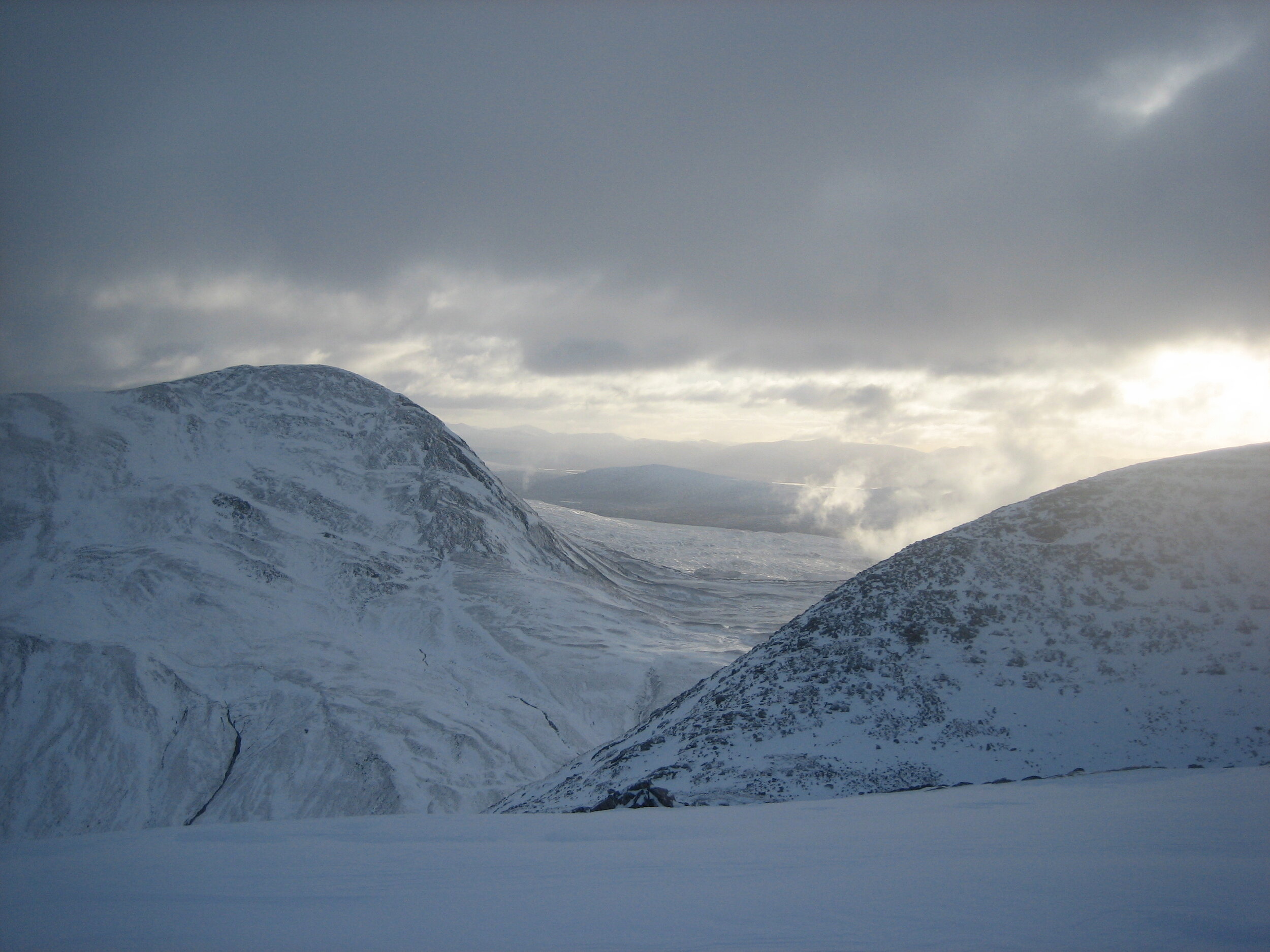
Sgurr Eilde Mor (on the left) shadowed by threatening clouds.
Aonach Beag 11:34
I reached the top of the descent gully (the quickest between Aonach Beag and Sgurr Choinnich Mor) Gary had warned my about. Whether ascending or descending, this was another significant obstacle on the Ramsay Round. My first thought was that it didn’t look too bad. It was narrow at the top, turned a corner round a rock and then disappeared out of sight. Perhaps Grade I at most I optimistically thought. Regardless I was about the test my theory about winter climbing in orienteering shoes. I slid my ice axe out from behind my shoulder and fastened it securely round my wrist. I turned to face inwards, swung my axe with a reassuring thud into the hard névé on the level ground at the top of the gully, lowered myself over the edge and kicked my first step… didn’t seem to bad. I repeated the process, committing myself to the gully. Soon I was descending, rhythmically kicking steps, carefully repositioning my ice axe and kicking another set of steps. After a few minutes I stopped and looked around me. I’d only moved short distance despite the effort. I could now see all the way down the gully to the col several hundred metres below. At this rate it would take all day to get down, I thought to myself. I looked at the rock buttress to my right and reckoned I could move faster on the broken rock and ledges, so I traversed over to it. I was moving quickly again, walking along rock ledges and lowering myself over small blocks of rock. Every now and then a ledge would be snow covered and I’d have to carefully stab my axe in while I dangled my feet over the void to drop on to the next tier of ledges. Often I simply jumped down from one ledge to the next. The studs on my O shoes were giving me awesome grip as I landed on the snow covered ledges. Now I was moving fast. I jumped to another ledge and the second my foot touched the snow, I knew I was in big trouble. The snow on the ledge cascaded down the buttress as I landed and I started to fall with it. As I slid over the edge, still a long, long way above the col below I smashed my axe into the remaining snow on the ledge and came to a stop; half my body dangling over the void below. “Be fucking careful!” I shouted at myself. I jumped down onto the next ledge, followed by a few more jumps, before traversing back into the gully, where the angle and eased and I was able to make quick progress again.
I’d filled up an inov-8 H20 hydration system for the first leg across the Aonachs and it was now empty. I had intended to rely on the bladder for fluid in this early section of the Round as there are few water sources, especially in winter. From here on in, I was going to rely on a 500ml water bottle and filling from natural water sources.
SMASH! SMASH! SMASH! My ice axe shattered a hole into a frozen loch and I plunged my bottle into the water. WOW! The water was really cold and almost instantly my hand started to go numb. However, the water tasted great to drink, very cold and very refreshing but I did immediately end up with an ‘ice cream’ headache. Drinking the water I continued eastwards, soon contouring round the false summit of Sgurr Choinnich Beag before beginning the short climb to Sgurr Choinnich Mor.
Sgurr Choinnich Mor 12:39
Stob Coire an Laoigh 13:10
Stob Coire Claurigh 13:50
Stob Ban 14:22
The next four Munro summits passed quickly and now – I struggle to recollect anything remarkable about them. I remember being up on my 24 hour schedule and feeling comfortable with my pace and level of effort until I started up the climb to the summit of Stob Ban. For the first time my legs felt tired and I had to concentrate to maintain my rhythm and pace. Fortunately I spotted some walkers on the summit as I approached, which encouraged me to keep running but I took the opportunity to chat with them once I had tagged the summit cairn. They were dressed for combat with the Scottish winter and, seeing me in my running kit, they asked what on earth I was doing. They seemed even more incredulous when I explained!
It transpired that these would be the last people I would see (or talk with) for the next 20 hours.
The track from the summit of Stob Ban lead quickly and easily down to Larig Leacah and the Leacach Bothy. I’d stayed here months before whilst attempting to recce this section of the route. However, the weather had been so poor that I’d never made it beyond the bothy and instead had simply spent a foul and frightening night listening to devilish noises as the wind screamed around the bothy and rain lashed the tin roof.
Running past the bothy now I had a strange feeling of security, passing a place that I knew, which was in contrast to much of the Round. The feeling of security quickly faded into serious tiredness as I felt my pace slowing again as I started climbing up Stob Coire Easain. For a while I plugged on, wearily trudging up hill. Suddenly, I remembered my secrete food weapon that I brought along for just this instance… fudge. I’d never eaten fudge before in similar endurance situations but a spur of the moment decision had seen me buying some the day before (it seemed like a great idea; something tasty and packed full of energy). I gobbled down half a packet, my mouth stung a bit but very soon I felt my pace quicken and my outlook improve.
Stob Coire Easin 15:59
The short ridge run between the twin summits of Stob Coire Easin and Stob A’Coire Mhead felt easy and I enjoyed the downhill running from the summit of Stob Coire Easin after the long up hill section. However, I was starting to struggle to keep up with my 24 hour schedule again and the sugar hit from the fudge had quickly worn away.
Stob A'Coire Mhead 16:17
The descent path from the summit of Stob A’Coire Mhead was at first distinct on the ground and I made rapid progress down towards Fersit Dam and the northern end of Loch Treig. However, at about 800m the ridge plateaued for a few hundred metres and I was drawn rightwards on a good trod as the main path became intermittent. At first the trod was good and I continued to make rapid progress, albeit loosing more height than I expected. Suddenly (and I suppose not surprisingly) the trod disappeared and I was stranded in deep undergrowth on the steep mountain side. For a while shear frustration drove me through the vegetation. Occasionally I’d break through and have a few dozen metres of fast terrain but then I’d be back into waist deep heather. All the time the ground was getting steeper and steeper with occasional rocky bluffs barring the way or forcing me further from my desired direction. I was getting really frustrated. I fought through the tangled mess of the mountain side still going down but now having to climb down the odd short rock wall or gully. Eventually the ground started to level out and I popped off the hillside next to Loch Treig, where there were some buildings and a track leading back to the dam. I was over 1km from where I wanted to be. Pissed off at how the trod and then terrain had forced me off route, I ran as hard as I could until I reached Fersit Dam. The speedy run to Fursit Dam had been hard but it kept me on my 24 hour schedule. I resolved to eat some more food on the next up hill section.
After crossing the dam, I turned south and followed the railway line alongside Loch Treig. I found it hard to run and blamed the uneven and loose bedding stones that the tracks were laid on. Just before the tunnel I spotted a little trod heading up left onto the flanks of Stob Sgriodain. Without any knowledge of the route here and with very little plan, it seemed as good a choice as any and I followed it up away from the railway line. Soon I was back into knee deep heather. I was very tired now. I kept finding myself pausing for a ‘breather’ but setting off at a slower pace than before. I wondered aimlessly up hill for some time before my tired brain started to function more clearly… I was bonking. I stopped and finished off the pack of fudge but my mouth was fairly sore and the fudge seemed to have lost its flavour. I didn’t enjoy eating and what little appetite I had was quickly fading.
Stob Sgriodain 18:36
The last afternoon light had faded into darkness as I approached the summit but the slow change had meant that my eyes had adjusted also. However, as I reached the top it was properly dark and I had to stop to organise myself for the long night ahead. My hat and second pair of gloves went on and my Silva headtorch was turned on for the first time. The instant bright light from the headtorch contrasted with the darkened mountain side and I was surprised at just how black the night felt outside the protective glow of the headtorch.
A short ridge run heading south east, whilst loosing height from the summit of Stob Sgriodain, lead to the broad saddle below Chno Dearg. The snow slopes glistened in the moon light when I turned off my headtorch to breath in some of the cold night air. As soon as I stopped I noticed the significant drop in temperature and I decided to put on my power stretch top. That was it; I had all my clothing on with the exception of a lightweight waterproof jacket. Staying warm overnight would now be dependant on moving quickly enough to generate sufficient heat.
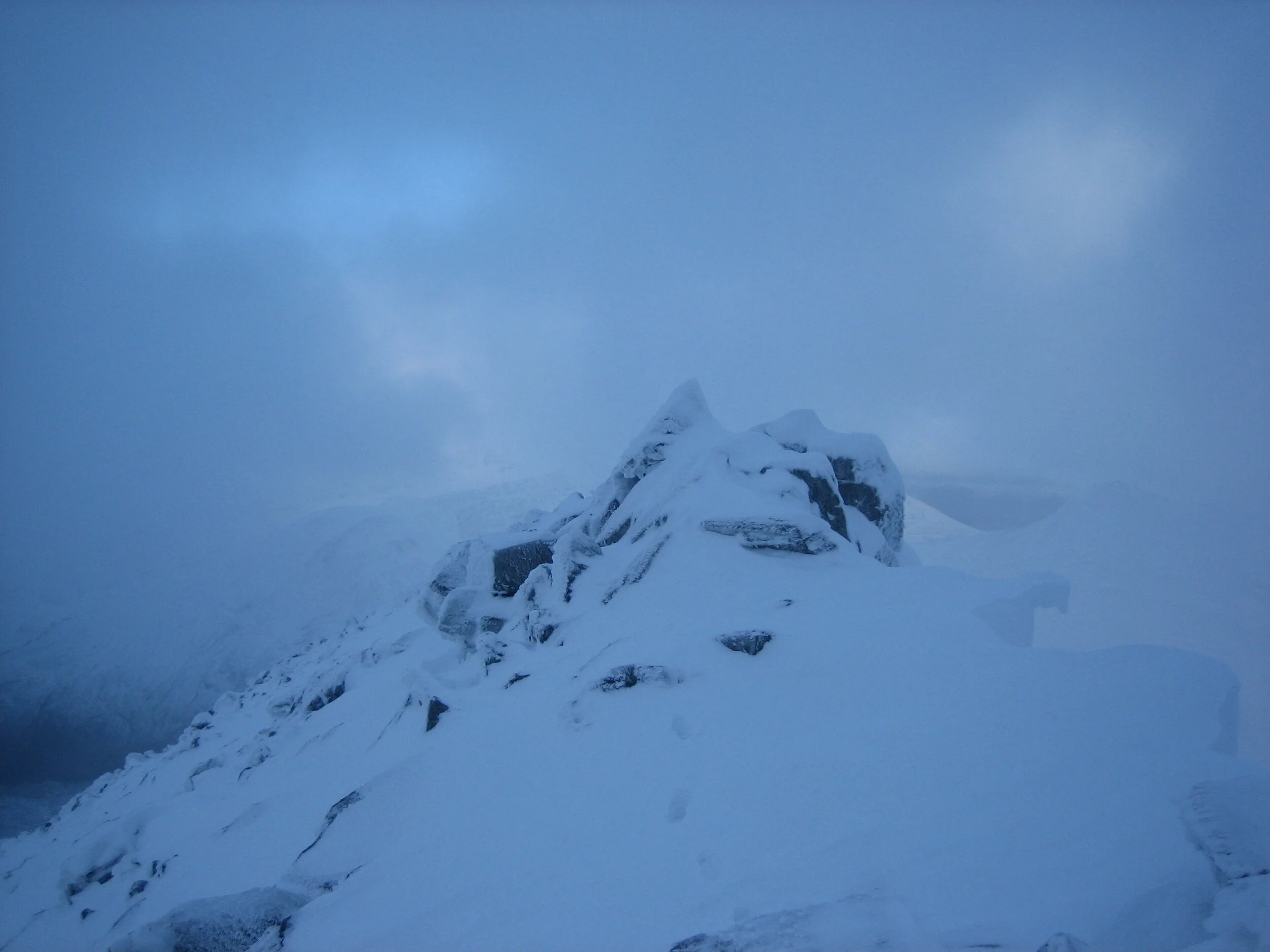
The narrow ridge on the summit of Binnen Mor with my footsteps centre on the obviously corniced edge to the right.
Chno Dearg 19:18
I raced off the summit of Chno Dearg, heading south towards a large cwm and still hopefully that I could make up the 40 minutes that I was now down on my 24 hour schedule. Night had fully enveloped the hills now and I was enjoying running on the snowy summit plateau by star and torch light. The ground started to fall away before me with my torch lighting up a smaller and smaller area as the void of blackness in front of me grew. I knew the ground in front of me was steep… mainly because I couldn’t illuminate it despite 100m worth of very powerful torch beam. I stopped and double checked the map. A few seconds pause and I could already feel the sweat on my body turning icy cold. I was in the right place. I pulled my ice axe out from between the rucksack and my shoulder, where I kept it for quick, instant access. I carried on running, quickly taking long, crazy long, strides down the snow slope. I started zigzagging. It was great to be moving so fast. The snow crunched under my feet and the tungsten studs on the bottom of my O shoes bit into the frozen crust of the névé. As suddenly as I was having fun and with no warning, the stubs lost traction and I fell heavily onto my side on the hard névé. Instantly I was sliding, accelerating into the blackness. For a second I was pleased that I was covering the ground even quicker than when running. My brain was starting to be numbed by the hours of hard effort and it took another half second to realise the danger I was in. Ice crystals sparked into the night sky, illuminated by the beam of my head torch as I ice axe braked. I came to a stop, heart racing. I had slid a long way, maybe 50, 60, 70m – I couldn’t be sure in the dark. Anyway the ground seemed less steep now and picked myself up, checked my compass bearing and continued zigzagging into the night.
I waded through the Allt Felith Thuil River at the bottom of the valley half way between Chno Deag and Bein na Lap. It wasn’t deep but my feet got an icy soaking. Now the long trudge up Bein na Lap begun. I was feeling tired again and my mouth stung after drinking the cold water from the river. At about 800m I crossed over the snow line once again and paused for a breather. As I watched, the valley below began to fill with mist as a bank of cloud rolled up the valley. The blackness of the wilderness night slowly changed as wisps of cloud reached out for me. The ghostly white wisps rose up, swirled around, and finally enveloped all around me. I just carried on trudging upwards and pretended to myself that the mist was a good thing, as I’d now need to navigate more carefully, and it would give me something to concentrate on. The ground started to level out and I knew I simply needed to turn right and to the south and follow the ridge to the summit of Bein na Lap. I walked for about 15 minutes. Really I should have been running up such a gentle slope but I felt too tired. Slowly making up hill progress, I expected the summit to appear any second but the minutes of trudging ticked by. I began to feel nervous. I checked my altimeter reading on the GPS. “Shit! That can’t be right!” I was much lower than expected. A sudden panic gripped my stomach – had I walked up the wrong hill in the dark? I selected waypoints on the GPS ‘take me to the closest’ option. It should be the Summit of Bein na Lap. “600m” and an arrow helpfully pointing up hill. “Phew”. At least I was on the right mountain! I checked the map again. I hadn’t been looking at it as I plugged away at the hill. I’d probably taken a poor bearing or just wandered off the line in the dark and mist and ended up further north along the ridge than expected. Obviously I was more tired than I realised. However, I felt composed again and carried on upwards. As suddenly as I thought I was lost, I broke through the valley mist into a spectacular starry night. I stopped briefly again to savoir the view. The rolling bank of mist was disappearing down the valley and I could see beautiful, clear blackness all around me.
Bein na Lap 20:57
I knew I was slowing down as I’d lost more time on my schedule whilst climbing Bein na Lap. A sub 24 hour Round now looked hopelessly optimistic. Although I knew I should be eating more if I wanted any chance of speeding up, my appetite had all but disappeared, my mouth felt sore and my brain was numbed. But, there was a long decent from the summit of Bein na Lap and as I ran down hill I tried to make up time. The impact of each stride was starting to hurt. I looked at the map and schedule and calculated. A sub 24 hour Round was still possible if I made a huge effort on the long sections of tracks and paths linking Bein na Lap with Sgur Elide Mor, the mountain at the start of the Mamores Ridge. I was going to go for it.
Long tentacles of snow reached down from the summit snow fields of Bein na Lap and the fastest running was along these rather than in the uneven grass and undergrowth exposed through the snow. As I dropped lower down the mountain, the amount of snow reduced but the gullies that texturise the mountain side still held the snow and I followed these down to the track.
I turned right and followed the track towards the southern end of Loch Treig and the Creaguaineach Lodge. I’d run for a while and then, feeling exhausted, have to walk again. The long, stony track was pummeling my feet. As each stride hit the ground, the hardness of the stones was projected through the steel studs of my orienteering shoes and vibrated up my leg. Each step was painful and I subsequently discovered that, at some point during the attempt, one of the metal studs on the ball of my right foot had pushed through the sole of the shoe, so the impact of each step was transmitted directly into my foot.
Reaching the loch, I knew I had to turn left but stopped to check the map anyway. Checking the map was becoming a useful reason (dare I say excuse) to rest. As I became more tired throughout the night, I needed to ‘check the map’ more and more frequently.
I don’t know where the time went during the night. Sliocgan Bothy appearing out of the blackness on my left; a beautiful but clearly haunted building. I followed the Abhainn Rath west looking for the crossing point that I had been told about. The sound of the rapidly flowing water was ominous; I had been told that at an altitude of 330m there was a crossing point, but I’d never been there before and I kept a close eye on my altimeter as I followed some good paths along the northern bank of the river. Eventually, a crossing looked possible. The altitude was correct and as I hopped between boulders I managed to cross without event getting my feet wet, much to my surprise.
I now picked up an intermittent fence line heading towards the Luibeilt ruins. The ground here was very boggy and, although the surface was frozen, I’d break through the ice with almost every step and my feet would get another freezing dunking. Picking up a new track I was able to turn to the south and towards Loch Elide Mor, which marked the start of the Mamores. After passing the buildings at the western end of Loch Elide Beag, I counted off the steams I passed on my right before turning right at the fourth stream and heading up the steep flanks of Sgur Elide Mor.
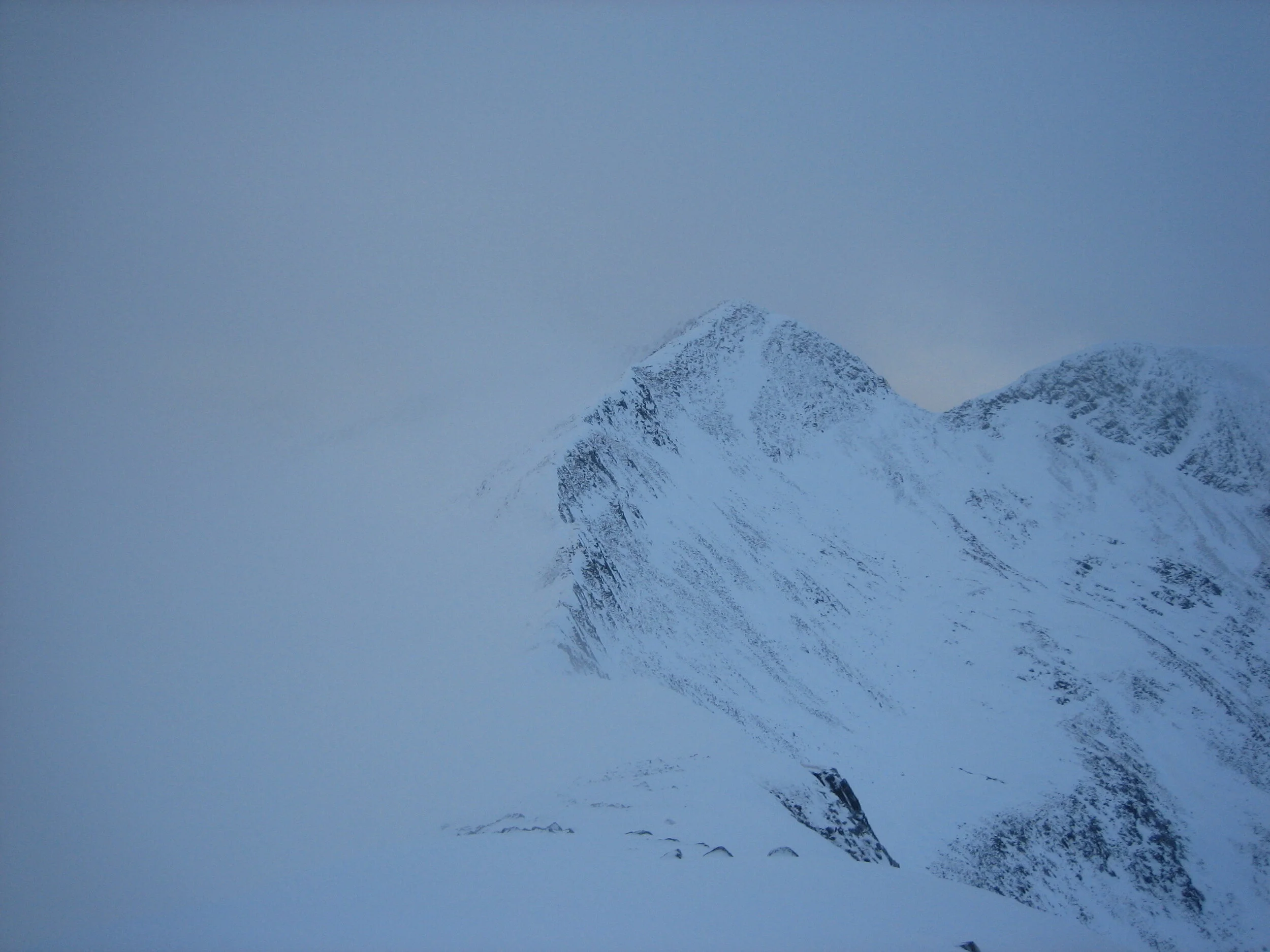
The unnamed summit 1062m in the foreground with Na Gruagaichean in the background.
My feet had been getting gradually colder for the past few hours. Numbness crept up my feet. First my toes had gone, then the balls of my feet, and now both entire feet were beginning to feel dead. I had carried a spare pair of socks for this eventuality, which I knew would happen at some point. I stopped. Again, as soon as I stopped I could feel the warm, damp sweat turning into lakes of frozen water. I would need to make this sock change a fast one. However, my O shoes were frozen solid with large blocks of ice and mud encasing the laces. “No problem” I thought, “I’ll just piss on my shoes to unfreeze them.” I stood there trying to piss. Nothing. I was too dehydrated to get even a dribble. “Shit.” I swirled my tongue around my mouth and spat into my hand and started to rub the icy laces vigorously. I spat again, repeating the process, rubbing as hard as I could. Nothing. My feet remained icy prisoners within my frozen shoes. I spat again, rubbed, rubbed, rubbed and there started to be some movement. I kept up the process (spit, rub, spit, rub) and eventually I was able to get my laces moving, wiggling and finally undone. I don’t know how long it took, but I was now shivering uncontrollably and my hands had gone numb from rubbing the icy shoes. I started on the second shoe. Once both laces were undone I quickly pulled off the saturated neoprene socks and Merino Wool socks I was wearing. I put another pair of Merino Wool socks on and pulled on some lovely thick SealSkinz socks. I was confident that my feet would soon be warm in these dry socks. I stuffed my numb hands under my arm pits and carried on slogging up the hill.
Twenty minutes later my feet were worse. The numbing cold had crept along from my toes all the way to my heel. I couldn’t believe it. I’d made a serious mistake by not rubbing my feet to regain the circulation when I stopped earlier. The realisation that I was going to have to stop again was tough mentally and I tried to put it off, hoping that another few minutes of hard up hill effort would pump warm blood back into my feet. It was no good though, I had to stop. I was risking frost nip or worse and besides if my feet got any more numb I wouldn’t be able to walk, let alone run.
I stopped and my morale instantly sunk to a new low as I realized that my shoes had already frozen over and were again encased in ice. I started the spit, rub, spit, rub process as my hands began to freeze and I shivered away on the dark hill side. I just wasn’t wearing enough clothes to stay warm if I wasn’t moving.
Eventually I got my shoes off again and started the process of rubbing the circulation back into my feet. It seemed to take ages and when I look back at the split times between Bein na Lap and Sgur Elide Mor, I can see that the hours slipped away in the darkness as I faffed around. Finally I got moving again.
Sgur Elide Mor 02:10
Slowly, slowly, slowly the summit of Sgur Elide Mor materalised in front of me. I knew I’d blown any chance of running a sub 24 hour Round during the long section from Bein na Lap. I was very tired, my legs and feet were very bruised and painful to touch. I hadn’t really been eating very much since early evening and despite feeling drained and desperately tired I just couldn’t bring myself to eat substantial amounts of food. I could just make out Coire an Lochain below as I started the descent from Sgur Elide Mor. I wasn’t going to fail.
I needed to pick up a path to my right (west) once I reached the col where Coire an Lochain was. I took a compass bearing and headed off safe in the knowledge that my bearing transected the path I needed to pick up. I reached the path fine, turned to my left and started to look for the path junction, where I needed to turn right. Only a few hundred metres I thought. 100, 200, 300, 400, now I was starting to get worried, 500. Stop! I looked around me, the black mass of the mountains on all sides silhouetted perfectly against the blue, grey of the starry night sky. I orientated the map. I was definitely in the correct place… well roughly anyway. I started to try and work out exactly where I was, carefully studying the map in the blinding white light and then trying to make out the contours on the ground. This was silly. I’d brought the GPS along precisely so I didn’t waste time like this in the dark. The screen was automatically displaying some key information including my current grid reference. I read it off and checked it against the map. I’d over shot the junction by a few hundred metres. I must have just missed it in the dark. I turned round and headed back. Another block of time down the toilet
Binnein Beag 04:00
A good stony path zigzagged up the western flanks of Binnein Beag. However, in the dark it was very easy to loose it on the scree covered mountain side. Reaching the summit I stopped for a few minutes, breathing in the cold night air. I started to shiver and turned, heading back down again trying to distinguish the same path amongst the mass of scree.
Approaching Binnein Mor there was a choice between the steep snow slope or the rocky buttress. On full power my head torch illuminated a towering, tidal wave of white snow reflecting eerily back at me. I guessed it would be technically easier kicking steps up this gully, but the névé was bullet hard and it would be tiring repeating the same action for several hundred metres. I was also concerned that if I slipped, I’d probably slide all the way back to the bottom, which would be demoralising to say the least! I opted for the rock buttress to the right of the gully. In the summer and in the daylight there is probably a nice easy route winding its way up through the rock. Now, in the middle of the night and with a layer of snow on many of the ledges, the whole buttress looked dark and ominous. I opted to get it over and done with as fast as possible, taking a ‘Super Directisma’ line up the wall of rock. Whenever there was choice, I always went straight up – never around. This was proper rock climbing. Occasionally, I need to whip out my axe and carefully place it in the snow as I crossed over a particularly snowy ledge.
Binnein Mor 05:20
The effort to go up was all-consuming. I was trying to go as fast as possible but I’d make maximum effort for 20 or 30m of vertical ascent and then have to stop, my heart bounding in my chest and my legs feeling like dead weights being dragged uselessly behind me. When I stopped I’d bury my face against the nearest rock, draw in deep breaths and prepare for the next section. I ignored the black space below me. I still wanted to move as fast as possible despite the huge amounts of time I had already lost to my 24 hour schedule. After a few seconds of rest I’d be moving again, heading up into the blackness of the night. I finally and suddenly pulled on to the top of the buttress. “This must be the top”. I checked the map for the height of Binnein Mor, it was 1130m. I checked the GPS altimeter…. Only 1090m. Again, that sudden wave of panic threatened to boil over inside me. Had I climbed up the wrong buttress in the dark? I went back to the GPS and selected ‘take me to nearest waypoint’. The GPS pointed out into the black night sky and straight off a cliff with a helpful arrow and 40m distance indication. I relaxed just a little. Next I selected GPS accuracy and it was plus or minus 40m. “Thank fuck for that” I breathed a sigh of relief as I realised I was on the correct summit after all.
On the summit I sent another text to Heather and Gary but also added a note that my battery was seriously low and I may not be able to send any more texts but that I was ok and planning to continue. Instantly a reply arrived back from Gary “put battery in inside chest pocket”. I couldn’t believe he was awake and the thought that someone was looking out for me cheered me up immeasurably.
Na Gruagaichean 05:56
Dawn had been teasing me for a while. As I made the final slow steps towards the summit of Na Gruagaichean, the sky to the east lightened imperceptibly at first, then slowly, slowly a blue, pink, red fusion of colour crept over the hills. It was a fantastic, awe inspiring sight and I sat on the summit to watch. Waves of pulsing red and pink colour washed over the hills towards me, seeming to race miles with each wave only to wash back across the hills until the next pulse of light rushed up from the horizon. An incredible sight. I watch for as long as I dared before the bite of the dawn chill snapped my mind back into focus. “I need to finish… soon”. Standing back up my legs screamed in protest, they were very stiff and very sore and the next minute of slow running was very difficult before they eased off a little.
I traversed across the cwm, holding a contour to save height as I headed up towards the An Gearanach ridge. WACK! I fell to the ground, landing heavily on the ice with my left hip and knee taking the impact, the breath temporarily knocked from me. I slid down the gently sloping ice until I came to a stop, laying there for a long time. I was totally exhausted and hadn’t even noticed the stream that had frozen as black ice over the rocks. Slowly I gathered myself together. The screen of my GPS had been cracked by the impact of the fall but it seemed to be working still. Heaving myself back off the ground was hard. I was reaching the point where I just wanted to stay still regardless of the consequences. I was dangerously tired now from the constant physical stress and lack of food.
An Gearanach 07:43
Finally I reached the summit of An Gearanach taking nearly twice as long as I had planned. From here onwards I had actually recce’d the Ramsay Round and this knowledge (as well as day break) lifted my spirits. I reversed my course back along the An Gearanach ridge towards Stob Coire A'Chairn.
Stob Coire A'Chairn 08:10
After the slow and physically draining night, I felt like I was moving ok again. Checking my time as I tagged the summit, I realised I was running at a sub 24 hour pace again. I managed to maintain this pace (or very close to it) for the next three summits, which I find incredible now given my physical and mental state at the time.
Am Bodach 08:50
Sgoran lubhair 09:19
Sgurr A'Mhaim 09:59
I stopped at Lochan Coire nam Miseach to fill my water bottle to drink while I climbed up Stob Ban. Again, I had that burning sensation when I drank and it was only days later that I learnt you could have cold burn to your mouth from repetitively drinking very cold water. With hindsight I can see why this contributed to my unwillingness to eat.
Enjoying the winter running condition in the Scottish Highlands.
I plugged away at the rocky ascent to Stob Ban. With every step my legs screamed with pain. Part of my brain was demanding that I stop but another part would not allow it. Head down I struggled on, slowly gaining height with each difficult step. Something moved to my right! I glanced over, momentarily distracted from the ascent. Nothing. I saw nothing. Head down, I carried on plodding. So much for being an elite runner, I thought to myself… I couldn’t win an egg and spoon race right now. There it was again, something moving among the rocks, something big, hiding just the other side of the ridge. Now I was really distracted. I was just staring at the rocks trying to make something out and then I saw it move, its long scaly back arching out of sight into the valley below. I thought I heard the slow beat of wings but just as suddenly there was nothing. I stared blankly at the rocks. “Did I just see what I think I did?” I looked around me, hoping someone else would be standing there in equal amazement. There was no one. I was alone. My head went down, resigned to the ascent before me. “Please be over soon”.
Stob Ban 11:09
When I recce’d this section in November 2007, I remembered running freely down from Stob Ban, dancing over the boulders and positively striding along the grassy ridge towards Mullach Nan Coirean. Back then I’d easily run at a sub 24 hour pace and I felt confident that I would be cruising the Ramsay Round later in the winter.
In reality, I was struggling to hold it together now. The hours of pounding that my legs had endured, especially with the dobs of my o-shoes amplifying every step, every stone, every rock, had reduced my muscles and joints to fulcrums of pain. I couldn’t really run anymore and suddenly I would find myself sitting down, doing nothing, just sitting. Resigned to whatever would happen next. I could hear lovely classical music drifting across the hills. I just sat there listening, soaking up the sun, enjoying a beautiful morning in the mountains. SNAP! My mind came spinning back to right now. The music stopped. I had to get up and carry on. I tried to move and I’m not sure if my legs or I screamed “No!” I grabbed the closest boulder and pushed myself up off the ground.
Mullach Nan Coirean 12:19
My body begged to stop. However, I knew that stopping was fine but getting going again was so painful that stopping for anything simple wasn’t an option anymore. I was moving, slowly, but I was still moving. As I left the summit of Mullach Nan Coirean, a small herd of brilliant white unicorns watched me watching them. I was very lucky to see them. Rare and majestic creatures indeed. WHACK! I stumbled again and fell, the mud squelching between my fingers. The jolt shocked me back to reality; the hallucinations were becoming more frequent and I was struggling to hold it together.
I picked myself up off the ground and headed down the ridge from the summit of Mullach Nan Coirean, but instead of following the path and ridge to the north east, I was drawn to my left and wandered aimlessly down in a north westerly direction.
I was too tired to be disappointed with this basic navigation mistake, which would cost me more time out on the hill. I could see the forest above the Youth Hostel and as long as I was going down, I was beyond caring now. I really didn’t care about anything. Every step my legs were wracked with pulsating pain.
Finally I woke from my dazed stumbling and had to admit that I really was in the wrong place. I stopped, orientated the map, checked the fence line that I had just crossed and slowly realised my mistake and where I actually was now. A wave of frustration nearly overcame me, “I just want to fucking finish!” I cried out. Then a wave of anger flowed through my veins and I ran as hard as I could, slightly europhic as the pain pushed me closer to the edge of delirium. I ran hard for kilometre and a half, correcting my mistake and ending up at the fence stile into the woods at above Polldubh Cottages.
This was the first time in a while that I had actually moved quickly but also the last. Exhausted, I crossed the stile into the forest and followed the boggy track down through the trees. Gary had warned me about making mistakes in this forest and I had dismissed the risk, confident that my navigation could handle anything that the Ramsay Round could throw at me. Now, battered, mentally and physically, I missed the forest ride that takes the quickest route down. Annoyed with myself I dropped into the next clear bit of forest, heading down as quickly as I could. However, I was soon tangled up in ‘fight’ (orienteering speak for forest so thick you literally have to fight your way through it). I could see the next forest track 10m away through the dense green. I pushed and fought through the brambles to reach it, wasting more and more time. Thorns embedded themselves in my legs, in my arms and I felt utterly desperate and frustrated. Eventually I popped out, emotionally drained and almost in tears from the effort of the past few metres. “I just want to finish…” I now mumbled to myself.
I missed another turn and eventually settled for taking the track all the way to Polldubh Cottages, which seemed to be all my brain could now handle. Eventually I reached the Glen Nevis road. I tried to run but only managed a few metres. “No more”. It was a lost cause… totally hopeless. The pain in my legs was just too much. It was about four kilometres to the Youth Hostel and I had just 30 minutes if I wanted to be within 30 hours. I did some quick mental arithmetic and reckoned I could walk it. Decision made. I decided not to look at my watch again. The time would be what it was going to be. I had nothing left to influence it.
Glen Nevis Youth Hostel / 14:27
Friday 15th February 2008
There was a note tucked under the wipers on the car windscreen. I couldn’t begin to conceive how Gary had managed to get it there. Perhaps I had finally lost the plot. It simply said “Congratulations. Awesome effort. Champagne waiting for you in the Youth Hostel”.
Thanks to…
I’d like to thank Gary Tompsett who provided me with invaluable information and advice. Also, thanks to Nick Wallis, Martin Stone and Steve Birkenshaw for their helpful comments and encouragement. Most of all I want to thank my girlfriend Heather, who is incredibly understanding of my incredibly silly adventures.
A Note about winter conditions
When you attempt one of the Rounds in the summer, naturally you wait for good conditions. Indeed, you would be foolish to set off in anything but. Likewise in winter you also wait for good conditions i.e. clear skies and no wind. However, for the attempt to be classed as a ‘winter Round’ certain conditions are prerequisite. Personally, I feel that it should be as close to the winter solstice as possible (so that you have minimal daylight), there should be snow cover on the ground, temperatures should be below zero and therefore ice axes and/or crampons are essential for completing the Round.
Photos
Please note that the photos used to illustrate this article were taken in December 2008 (i.e. not on the actual record round), whilst recceing the route for a future (faster) attempt.